
Geocaching
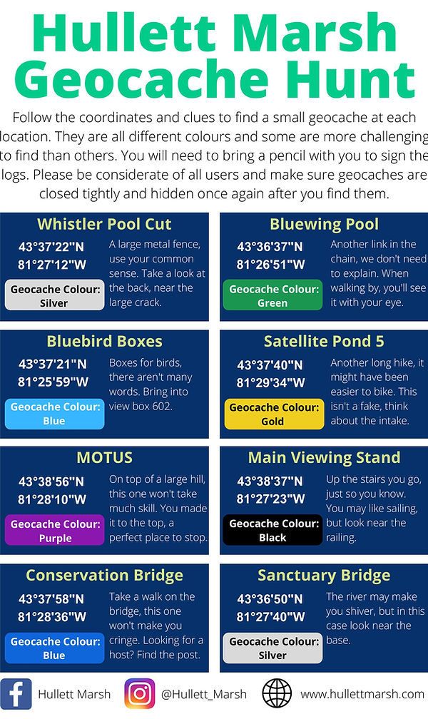
Hullett Provincial Wildlife Area offers a unique landscape for geocaching, the world’s largest high-tech treasure hunt. By using GPS-enabled devices or smartphone apps, visitors can navigate to specific coordinates to discover "caches" hidden by the community throughout our 5,400 hectares of wetlands, meadows, and forests. This activity provides an engaging way for families and outdoor enthusiasts to explore the marsh’s extensive trail systems, offering a goal-oriented adventure that highlights the diverse geography of the property.
To participate, visitors simply need to create an account at Geocaching.com or use the official mobile app to view the locations of hidden containers within the marsh. Once you have navigated to the coordinates, the challenge is to find the physical container, which can range from large ammunition cans to tiny "micro" canisters. After signing the logbook inside, you may find small trinkets for trade; the general rule is that if you take an item, you should leave something of equal or greater value behind. Logging your find digitally afterward allows you to share your experience and photos with the global geocaching community.
Whether you are searching for a quick find near the parking areas or embarking on a long-distance hike to find a remote cache deep in the interior, geocaching at Hullett is a rewarding way to connect with nature. Because cell service can be intermittent in the more secluded sections of the marsh, we recommend downloading map data for offline use before starting your journey. We invite you to grab your GPS, lace up your hiking boots, and discover the hidden treasures waiting for you at Hullett Marsh.
Please be mindful of the seasons, as certain areas of the marsh are highly active during hunting periods; checking our seasonal maps before you head out ensures a safe and respectful experience for everyone.